Chronology: how old is Odessa and what's its name?

The story of the city of Odessa is probably one of the most blatant historical lies we can spot. I stumbled into this entire story via a monument to Napoleon as First Consul. The monument is located on the island of Corsica.
The Google image searching algorithm suggested a few similar images, with a monument to Duke of Richelieu being one of them.
Never mind that de Richelieu (1766 - 1822) and Napoleon (1769 - 1821) are wearing our regular ancient Roman stuff.

duc-nap-1.jpg

Apparently the monument to Minin and Pozharsky, and the monument to Duke of Richelieu were made by the same person, Ivan Martos. While trying to figure things out the following article came on my radar.
  • Plagiarism or provocation? Odessa Duke hides a sword in a "narrow" toga, and in Corsica - almost the same Napoleon.
    • That was some interesting reading.
sword-1.jpg


Duke de Richelieu and Odessa
Odessa is currently a Ukrainian city. Naturally, it was interesting to figure out why they have a monument dedicated to some French dude. There it goes. Armand-Emmanuel Sophie Septimanie de Vignerot du Plessis, 5th Duke of Richelieu and Fronsac, was a prominent French statesman during the Bourbon Restoration. He was known by the courtesy title of Count of Chinon until 1788, then Duke of Fronsac until 1791, when he succeeded his father as Duke of Richelieu.
1766-1822
Armand_Emmanuel_Duke_of_Richelieu.jpg

Source
As a royalist, during the French Revolutionary Wars and Napoleonic Wars, he served as a ranking officer in the Russian Imperial Army, achieving the grade of major general. In the Russian army, he achieved the rank of Major General but later resigned his commission after what he considered an unwarranted reprimand by Catherine's successor, Czar Paul I.
  • His prospects brightened, however, after Paul was murdered in 1801.
  • The new Russian emperor, Czar Alexander I, was one of his friends.
  • The erasure of Richelieu's name from the list of prohibited émigrés who could not legally return to France, which Richelieu on his own had previously been unable to secure from Napoleon Bonaparte, was accorded on the request of Alexander's new imperial government, and in 1803 Alexander appointed him Governor of Odessa.
  • Two years later, he became Governor-general of a large swathe of land recently conquered from the Ottoman Empire and called New Russia, which included the territories of Chersonese, Ekaterinoslav and the Crimea.
    • That's a huge chunk of land.
  • He commanded a division in the Turkish War of 1806–1807, and was engaged in frequent expeditions to the Caucasus.
  • Richelieu played a role during Ottoman plague epidemic which hit Odessa in the autumn 1812.
  • In the eleven years of his administration, Odessa greatly increased in size and importance, eventually becoming the third largest city in the empire by population.
  • The grateful Odessites erected a bronze monument to him in 1828.
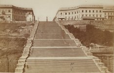
  • These are the famous Odessa Steps, crowned by a statue of Richelieu.
  • Following the Bourbon Restoration (1814), he returned to his homeland and was twice Prime Minister of France.
KD: So, our French national Duke de Richelie could return to France in 1803, but instead he became the Governor of Russian Odessa, and Governor-general of New Russia? By the way, this Governor-general means the following:
  • Governor-general in modern usage, is the title of an office-holder appointed to represent the monarch of a sovereign state in the governing of an independent realm as a viceroy.
  • Governors-general have also previously been appointed in respect of major colonial states or other territories held by either a monarchy or republic.
Instances like this could answer questions like this:Viceroy of Muscovy... What colony? Who was he?
  • Russia or Muscovy?
viceroy-of-muscovy-1838.jpg


The City of Odessa
How old is Odessa in reality? Let's see if we can answer this question. Let's start with the narrative. Odessa is the third most populous city of Ukraine. Odessa is sometimes called the "pearl of the Black Sea", the "South Capital", "The Humour Capital" and "Southern Palmyra".
  • Before the Tsarist establishment of Odessa, an ancient Greek settlement existed at its location.
  • A more recent Tatar settlement was also founded at the location by Hacı I Giray, the Khan of Crimea in 1440 that was named after him as Khadjibey.
    • Khadjibey was a fortress and a haven by the Gulf of Odessa, in the location of the modern city of Odessa.
  • After a period of Lithuanian Grand Duchy control, Hacibey and surroundings became part of the domain of the Ottomans in 1529 and remained there until the empire's defeat in the Russo-Turkish War of 1792.
  • In 1794, the city of Odessa was founded by a decree of the Russian empress Catherine the Great.
The Name "Odessa":
  • The city was named in compliance with the Greek Plan of Catherine the Great.
    • The Greek Plan was an early solution to the Eastern Question which was advanced by Catherine the Great in the early 1780s
    • It envisaged the partition of the Ottoman Empire between the Russian and Habsburg Empires followed by the restoration of the Eastern Roman Empire centered in Constantinople.
    • OMG: this is such a baloney induced mambo-jumbo.
  • It was named after the ancient Greek city of Odessos, which was mistakenly believed to have been located here.
    • Lie #1: "ancient Greek"
    • Lie #2: "mistakenly believed"
  • Odessa is located in between the ancient Greek cities of Tyras and Olbia, different from the ancient Odessos's location further west along the coast, which is at present day Varna, Bulgaria.
Photographs of Odessa
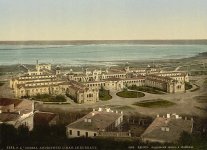
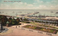
Odessa is probably one of the most beautiful cities I've never been to. These are older (19th century) photographs, so I'm not sure how many of the "ancient" buildings survived the carnage of our self-destructing civilization.
Odessa was the site of a large Greek settlement no later than the middle of the 6th century BC (a necropolis from the 5th–3rd centuries BC has long been known in this area). Some scholars believe it to have been a trade settlement established by the Greek city of Histria. Whether the Bay of Odessa is the ancient "Port of the Histrians" cannot yet be considered a settled question based on the available evidence.
  • What is a "large" Greek settlement? Was it a camping tent, 50 camping tents, a village, a town or a small city?
  • If it was a small city, why don't you historians just call it a small city then?
In the Middle Ages (5th to the late 15th centuries) successive rulers of the Odessa region included various nomadic tribes (Petchenegs, Cumans), the Golden Horde, the Crimean Khanate, the Grand Duchy of Lithuania, and the Ottoman Empire.
  • Since middle of the 13th century the city's territory belonged to the Golden Horde domain.
  • On Italian navigational maps of 14th century on the place of Odessa is indicated the castle of Ginestra, at the time the center of a colony of the Republic of Genoa (more Gazaria).
  • At times when the Northern Black Sea littoral was controlled by the Grand Duchy of Lithuania, there existed a settlement of Kachibei which at first was mentioned in 1415. By middle of 15th century the settlement was depopulated.
During the reign of Khan Hacı I Giray of Crimea (1441–1466), the Khanate was endangered by the Golden Horde and the Ottoman Turks and, in search of allies, the khan agreed to cede the area to Lithuania.
hadzhibey_1899-1784.jpg

Khadjibey came under direct control of the Ottoman Empire after 1529 as part of a region known as Yedisan after one of Nogay Hordes, and was administered in the Ottoman Silistra (Özi) Eyalet, Sanjak of Özi.
  • In the mid-18th century, the Ottomans rebuilt the fortress at Khadjibey (also was known Hocabey), which was named Yeni Dünya (literally "New World").
The sleepy fishing village that Odessa (whatever that means) had witnessed a sea-change in its fortunes when the wealthy magnate and future Voivode of Kyiv (1791), Antoni Protazy Potocki, established trade routes through the port for the Polish Black Sea Trading Company and set up the infrastructure in the 1780s.
The city of Odessa, founded by the Russian Empress Catherine the Great, centers on the site of the Turkish fortress Khadzhibei, which was occupied by a Russian Army in 1789.
  • The Flemish engineer working for the empress, François Sainte de Wollant recommended the area of Khadzhibei fortress as the site for the region's basic port: it had an ice-free harbor, breakwaters could be cheaply constructed that would render the harbor safe and it would have the capacity to accommodate large fleets.
  • In 1794 Catherine approved the founding of the new port-city and invested the first money in constructing the city.
Appreciate the BS when you see it: However, adjacent to the new official locality, a Moldavian colony already existed, which by the end of the 18th century was an independent settlement named Moldavanka.
  • Some local historians consider that the settlement predates Odessa by about thirty years and assert that the locality was founded by Moldavians who came to build the fortress of Yeni Dunia for the Ottomans and eventually settled in the area in the late 1760s, right next to the settlement of Khadjibey (since 1795 Odessa proper), on what later became the Primorsky Boulevard.
  • Another version posits that the settlement appeared after Odessa itself was founded, as a settlement of Moldavians, Greeks and Albanians fleeing the Ottoman yoke.
Odessa narrative based summary: The city of Odessa was established in 1794.
  • Prior to it there was a fort and some Moldavian settlement there. Moldavians were not really smart back then, otherwise they would have never established a settlement right next to a constantly attacked fort.
  • Oh, and some ancient Greeks had a colony there, gazillion of years ago.
  • This ancient Greek colony was called Odessos. Sure enough, they wrote it down for us to inherit the name.
The Age of Odessa: 227 years old in 2021.
The city of Ochakiv
We will need this "settlement" for what follows. Ochakiv also known as Ochakov is a small city in Mykolaiv Oblast (region) of southern Ukraine.
  • Ochakiv (founded in 1492, right?)
ochakiv.jpg


The river of Dnieper
We will need the location of the mouth of this river. The Dnieper is the longest river of Ukraine and Belarus and the fourth-longest river in Europe, after Volga, Danube and Ural. The total length is approximately 2,200 km (1,400 mi). Historically, the river was an important barrier, dividing Ukraine into right and left banks.
dnieper11.jpg

Map
Important: The river of Dnieper is the river of Borysthenes. (Ancient Greeks wrote it down, and we found the records, lol)

Dnieper Changed its course
In a way (and time frame) similar to the Indus river, the river of Dnieper changed its course. This major change did not happen thousands of years ago. We are talking between 1600 and 1800. Pay attention to Borysthenes and Dnieper river as we go through the maps.

Ancient Odessa
I assume this is the "ancient Greek" colony of "Odessos" we are seeing on the below older maps. Of course, the information presented on these 17th century maps is not "ancient". Certain things do not change. Their lies have a pattern.
  • Remember: Borysthenes River = Dnieper River
1590
1590-map.jpg

Source

1607
1607-map.jpg

Source
As far as I understand, our Borysthenes river ceased to exist, and turned into two rivers:
  • The Bog river
  • The Nieper river aka the Dnieper river
You can also see that the city of Ordessus turned into the city of Oczakow.
  • This Oczakow (Ordessus) is not the city of Ochakiv.
I believe the narrative really wants us to thinks that Oczakow and Ochakiv were one and the same. Here is what I think those reasons are:
The narrative needs to figure out what they had at Ochakov-Ochakiv, a city, or a fortress.
KD: Ordessus is Oczakow is Odessa (imho). It was conquered during the so-called Russian-Turkish War of 1787–1792.
  • The city of Odessa was established in 1794, but it was not... it was already there.
1636
1636-map.jpg

Source
As you can see, by 1815 the city of Odessa was firmly plated on a map. The Dnieper river moved to "Square #2".
  • Actually Odessa was (in mass) present from about the narrative dates, but maps between 1650s and 1800 are somewhat weird.
1815
1815-map.jpg

Source
Considering that Ochakiv-Ochakov name is not present on the above 1815 map. I will add one where it is present. Methinks, it's fairly obvious that:
  • Odessa = Oczakow
  • Oczakow Ochakiv/Ochakov
1812
1812-map.jpg

Source

Older Texts
Now, when we (somewhat) established via maps that there was already a city at the current location of Odessa, let's see if these observations can be confirmed by older texts.
  • Examining older texts, it's important to remember that they are full of lies too.
  • Fortunately for us, it is much harder to lie when your contemporaries are still alive.
1592
ordessus-0.jpg

Source

1674
ordessus-1.jpg

Source
Wanna see where our historical establishment moved the river of Ordessus? Check this out:
  • The Argeș is a river in Southern Romania, a left tributary of the Danube.
  • The river is believed to be the same as Ὀρδησσός Ordessus, a name mentioned by Ancient Greek historian Herodotus.
1812
ordessus-3.jpg

Source

1701
ordessus-4.jpg

Source
Vytautas the Great (c. 1350-1430) aka Witold Kiejstutowicz, Witold Aleksander, Witold Wielki, Vitovt, Alexander Vitoldus, Wythaws or Wythawt.
map.jpg


Battle of Ochmatów
Ochakiv, Ochakov, Oczakow, Ochmatow, Okhmativ... this is getting somewhat comical. Now we have a village of Okhmativ (population of about 800 inhabitants). It (or its vicinity) was the site of two large battles in the 17th century:
Something tells me that all four of these events were one and the same:
1732
ordessus-8.jpg

Source

1711
I would call the below text a partial historical BS. Herodotus and Pliny are being talked about, like they were some ancients, but that's besides the point. What we see here is the river Bog falling into Dnieper near Oczakow. Scroll up to the 1607 map, and take a look.

ordessus-9.jpg

Source
Below we can see what an adjusted for its time narrative looks like. I guess stuff like this was alright for 1803. This makes the Ochakiv fortress ~2,485 years old. That's some durable construction materials right there.

1803
ordessus-36.jpg

Source
Books summary: There are tons of books mentioning Oczakow on Google Ngram Viewer. There are a few where some minimal info was published about Ordessus. I did not search for other spelling versions. I have not seen Oczakow being described as some humongous city. At the same time I did not see any description of the "settlement" at all. I have no idea what the difference between a town and a city was back then.
  • Books do appear to confirm that Oczakow was located where today's Odessa is located.
  • Books do mention a fortress with one or two towns right next to it.
Illustrations of Oczakow
In addition to variously dated maps and texts, we have some illustrations of Oczakow. Unfortunately, all of them pertain to the Siege of 1788. Per the narrative, the Ochakiv fortress was supposed to be somewhere here.
  • I cannot save a single photograph of anything pertaining to this particular fortress to save my life.
  • If you can find something, please share.
Anyways, here are the images we have:
  • The capture of Ochakov by Prince Grigory Potemkin on December 17, 1788
oczakow-2.jpg
  • The Siege of the Fortress Ochakov on December 1788.
  • Source
oczakow-1.jpg
January_Suchodolski_-_Ochakiv_siege.jpg
  • The battle of Ochakov. Engraving by A. Bartsch. 1792.
  • Source
Sturm_Ochakov.jpg
  • Field Marshal G.A. Potemkin receives a captive Turkish Pasha after the capture of Ochakov in December 1788.
    • Fragment of an engraving (I'd love to see the entire thing)
  • Source
ochakiv-56.jpg

This is one humongous "Ochakov" in the background.
och1.jpg


Compare to This
On the images above we see a decent size town or city. Now compare to the below two images. I believe they suit the current narrative much better.
  • Siege & assault of the fortress Ochakiv, June 1787 - 17.12.1787, engraving, circa 1810.
    • I thought it happened in 1788
ochak-1.jpg
  • Naval battle between the Russian and Ottoman fleets on June 22, 1788.
  • Source
ochak-4.jpg

KD: On the top drawings of Oczakow, we can clearly see that a pretty large star city or town is being attacked. We are supposed to believe that it was today's Ochakiv. I think it was today's Odessa getting attacked and conquered.

Some Odessa facts:
  • 1794 - Odessa founded by decree of Catherine II of Russia
  • 1795 - Population: 2,250
  • 1802 - Population: 9,000
  • 1812 - Plague
  • 1814 - Population: 25,000
  • 1838 - Plague
  • 1850 - Population: 100,000
  • Source: History of Odessa
Odessa in 1830s
Odessa_1837y.jpg

Source

Odessa in 1850
1850_map_Odessa.jpg

Source

Odessa Opera and Ballet Theater
Considering that the entire city of Odessa in 1810 had to have about 20,000 citizens, I was simply unable to ignore this interesting story. I live in a town of about 100k, and it was founded in the 19th century. We do not have anything even remotely close to either one of the two Odessa buildings I'm about to show you.
1810
- we do not count the building on the left -
first.jpg

Source
This is what this Opera House looked like in 1873 (allegedly) after it was destroyed by fire.
  • On the night of 2 January 1873, the building was gutted by fire.
1873
opera-theatre_history-old_theatre_posle_pogara.jpg

Here comes the replacement. The modern building was constructed by Fellner & Helmer in neo-baroque (Vienna Baroque) style and opened in 1887.
  • A fund raising campaign began immediately.
  • The city announced an international contest for the best theatre design.
  • Forty designs were submitted, but none was chosen.
  • Finally, the project was drafted along the lines of Dresden Semperoper built in 1878, with its nontraditional foyer following the curvatures of auditorium.
  • Two Viennese architects, Ferdinand Fellner and Hermann Helmer began to construct the larger replacement in 1883.
  • The foundation stone was laid on 16 September 1884.
  • On 1 October 1887 the theatre was completed.
  • The architecture of the luxurious audience hall follows the late French rococo style.
  • The unique acoustics of the horseshoe-designed hall allows performers to deliver even a whisper-low tone of voice from the stage to any part of the hall.
1887
second.jpg

Source
Fellner & Helmer architects, lol sure why not. Please take a look at their wiki pages for some amazing info:
Now check out their Fellner & Helmer wiki page for some additional pertinent information, and... to see an incomplete two page list of what they built. Isn't it something?
Chronology
I'm not gonna elaborate on the chronology issues. I do understand that the contents of the below chart are confusing and look ridiculous. For those who want to get a better idea, here is where you can get it:
chrono.jpg


KD's Summary: Something is not right about Odessa and its history, that's my opinion. I think it's quite probable that Odessa is a bit older than we are being told. In this case we would have something like this:
  • Ordessus is Oczakow
  • Oczakow is Odessa
  • Oczakow is not Ochakiv, its Odessa.
 
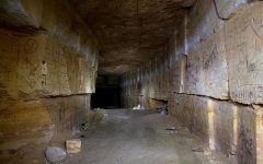
Also please check out the catacombs in Odessa. Please!
I didn't even know those existed. Thank you.

odessa-catacomb-5.jpg
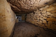
  • The Odessa Catacombs are a labyrinth-like network of tunnels (subterranean cavities) located under the city of Odessa and its outskirts in Ukraine, that are mostly (over 90%) the result of stone mining, particularly coquina.
  • The first underground stone mines started to appear in the 19th century, while vigorous construction took place in Odessa.
  • The system of Odessa Catacombs consists of a network of basements, bunkers, drainage tunnels and storm drains as well as natural caves.
  • The Catacombs are on three levels and reach a depth of 60 metres (200 ft) below sea level.
  • It is one of the world's largest urban labyrinths, running up to 2,500 kilometres (1,600 mi).
  • Parts were used as air-raid shelters during World War II. Part of the tunnels, only under the city, were turned into bomb shelters in the Cold War.
    • Such bomb shelters supposed to be refuge for civilians in case of nuclear strike or gas attack.
  • In the 19th century, most houses in Odessa were built of limestone that was mined nearby.
  • These mines were abandoned and later used, and widened, by local smugglers, creating a labyrinth of tunnels beneath Odessa.
  • Stories of smugglers are part of urban legends about treasures hidden underground.
  • Many of the tunnels under living areas were filled up with earth, concrete or sand by construction companies, and are no longer available.
  • Odessa Catacombs
1,600 miles long... that's pretty incredible.
 
Because you said you visited I hesistated mentioning the catacomben but it seems not very tourist- friendly...
The stone mining story is really weird: dug out ground from *under* your house to build your house on top...
And if that is the way: how were other cities built?

There seems to have been a great fire around 1918 that whiped away a whole neighbourhood:
Odessa plague in 1812, so only 18 years after they built all this city:
"Any houses the dead left behind were set on fire and burned to the ground."

Free Port Odessa.
Where did they find time to build all this?
These people moved faster than light.

There is also a rare book: Odessa ruins with drawings between 1880 and 19something and that seem Greek-ish ruins but I lost the name of that painter 😭
Edit:
Found it. Odessa ruins
 
Last edited:
Because you said you visited
Nah, I said I've never been to Odessa though I'd love to visit. The narrative on these catacomb caves appears to be pretty shaky. The man-made disaster of 1918 you posted is pretty interesting as well. That is in addition to what they had going on in 1812. Odessa is a researchers heaven. I wish there was more info in English though.
 
Odessa is probably one of the most beautiful cities I've never been to
I read too fast, in a language that is not my native. I read: "ever been to" and pictured in my head you strolling there in the streets and then myself going to Odessa (that was once on my list) and I thought oooh wish I were there strolling around these beautiful buildings....

On several maps I find Ocsakov on the place of Odessa. This one is particular interesting because of it mentions too not only Biela and seems very accurate, but also mentions the Dukes of Muscovy and Alba Russia (White Russia) but also city of Coporia on the site of St Petersburg.

Here is another map with a city Oezokiv on the now place Odessa, in my opinion.
 
Very heavily populated star fort area, the forts are now mostly decimated, the images in this thread scream out to me that that was the purpose of the invasions.

The is also a WOW line that runs north to the city pictured below, the distance is 350km from fort to fort on a hading of close enough to 333 deg.

Something very fishy about Russia's bread basket.

Screenshot 2021-07-28 at 22.40.53.jpg


Screenshot 2021-07-28 at 22.44.05.jpg


Screenshot 2021-07-28 at 22.45.58.jpg


Screenshot 2021-07-28 at 22.47.28.jpg

Here is a copy of the Russian star fort map, all the red dots you see.
 

Attachments

  • Russian star fort map.kmz.zip
    350.2 KB · Views: 591
These articles are amazing, but really hard for me to fully wrap my brain around (probably at least partially the point here).
  • Ordessus is Oczakow
  • Oczakow is Odessa
  • Oczakow is not Ochakiv, its Odessa.
I think that makes sense, but there are likely more possibilities because this is so convoluted. Like the river situation:
As far as I understand, our Borysthenes river ceased to exist, and turned into two rivers:
  • The Bog river
  • The Nieper river aka the Dnieper river
So, if I'm following correctly, the Borysthenes river (which would have been located next to modern day Odessa) apparently disappeared and the modern Dneiper river is furthest west, where it appears there did not used to be a river. This is the sort of stuff that makes me think there could have been a series of "innocent" mistakes after a major cataclysmic event(s)... you go to look for a river and it isn't there anymore, and then there is a river further west where there wasn't one, so you draw the conclusion that historical mapmakers were simply imprecise.

Which would be a lot easier to believe if there wasn't a "settlement" clearly depicted in Odessa's spot centuries before it's establishment. But like KD notes, that's a neat trick to just say "settlement" because it "explains" why something would appear on a map (but obviously doesn't explain how you'd bother to demarcate a camp or fort, but fail dramatically at positioning a massive river).
  • Odessa = Oczakow
  • Oczakow Ochakiv/
Which brings me back to, this is probably generally true, but good luck parsing what events belong to Odessa's history and which ones belong to Ochakiv's. That 1711 source seems to still be equating Oczakow with Odessa based on geographic description, which sort of makes sense to me based on a rough outline of time - we have "antiquity", from which little information survived, the " "transitional period" from the (as we generally think of it) late 15th century to the 19th century, when the groundwork for the current narrative was laid, the 19th to early 20th century, when the general premise was ready to be rolled out to the world while finetuning it, and then the modern era.

Anyway, all of this really illustrates how simply you can confound something by a little re-naming. Most of the information we have historically to locate places is based off of "known" landmarks, so by playing games with their titles, you can really create an entirely new narrative.
 
Anyway, all of this really illustrates how simply you can confound something by a little re-naming. Most of the information we have historically to locate places is based off of "known" landmarks, so by playing games with their titles, you can really create an entirely new narrative.
Odessa vicinity is just one relatively small area where they did it. I don't think people caught on to what they did with the Indus Valley. When you think about it, the Indus Valley one is pretty huge.
 
Well... With this Kinburn island only, I am already walking in circles:

The present peninsula - Kinburn - in ancient times was well known to Phoenician merchants and pirates.
This land was once called Gileia (Borisfenida).
“If you cross Borisfen (Dnieper), then Gilea will be the first from the sea, and the Scythian farmers live above it,” the ancient Greek historian Herodotus, who visited this land in the distant 5th century, wrote about the Kinburn Peninsula. "Land under a dense forest" (ancient Greek - Gilea) was well known to the Olviopolites (VII-VI centuries BC).


But, Borisfen = Berezan
Berezan Ancient Greek: Borysthenes) is an island in the Black Sea at the entrance of the Dnieper-Bug Estuary

On
this map Borysthenes is Odessa.

This guy here places Berezam next to Oezakov, that looks like situated on the now Odessa location.
 
If you cross Borisfen (Dnieper), then Gilea will be the first from the sea, and the Scythian farmers live above it,” the ancient Greek historian Herodotus
We can't really apply this to our contemporary maps.

bo-1.jpg

Map - Map
Today, the mouth of Dnieper is 70 miles East from where it was at the times of Oczakow.

bo-3.jpg
 
I don't know anymore, these 16th century map drawers were pretty confused and were still using ancient Greek names too.
Very outdated.
Do I see "Ordessna" on this map?
 
It just could be that we are more confused today than they were back then
This is a point that can't be made enough. If a crime occurred, whose testimony would be more credible: the eyewitness, hours after the incident, or their great great grandchild's centuries later? The answer is obvious, but the same logic is not applied when we assess historical documents. Our modern interpretations are considered more credible because of the underlying, but rarely spoken, premises that we are smarter, have more tools/evidence available, and are generally more honest when compared to our ancestors. But it's just the "myth of progress." I'm sure there are times when we have a better understanding than we used to, but when presented with discrepancies like in this article, the only answer a "professional" historian can present is "well, the mapmakers were just wrong" not because of any direct knowledge, but because the implications of the maps being more or less accurate are too damning to the paradigm that writes their checks and grants their prestige.

Everyone's interpretation will vary, but we're not talking about minor things, like a town being mislabeled and a few miles from its proper location. Things like misplacing a river's general direction and location by dozens of miles and having large lakes with completely different shapes (or appearing/disappearing entirely) are major issues, compounded by then having essentially every other mapmaker replicate the same error. Unlike other texts, maps have a very practical purpose as a tool and you would think if your product is grossly inaccurate that you would quickly lose your clientele (which makes me think again about these alleged "ancient Greek" names... would you buy a map that not only places things in the wrong spots, but refers to everything by archaic terminology? I guess travelers were basically the "hipsters" of their day...) When you compare the alleged geographic inaccuracies to the splendor of the buildings, clocks, and other tech of the era, it really doesn't make a lot of sense.

Even if these maps were inaccurate, that's problematic by itself as it creates the impression that human beings were starting from scratch, so to speak. Ancient Greeks allegedly were able to identify the shape and calculate the size of the Earth, but millennia later, we can't place a river within fifty miles. Was no knowledge preserved, even verbally? (Oh right, it was "lost" but then "found"... didn't seem to help these 15th to 18th century maps though...) We then butt up against another myth as a potential for hand-wave dismissal, the "Age of Exploration", as if people had no interest in traveling prior.

It's all just a bunch of suppositions based on philosophy, not evidence, like almost every field related to academia.
This 1590 map was included in the OP.
As an aside, I wish that the David Rumsey links ever actually worked. They always just lead back to the search page unless you enter in a search term to narrow it down. Like this link after I added "1590 Ukraine".
 
Our modern interpretations are considered more credible because of the underlying, but rarely spoken, premises that we are smarter, have more tools/evidence available, and are generally more honest when compared to our ancestors.
This striked me when I went to a remote so-called backwards area in Slovakia (the farmer area behind Giraltovce) and these people were able to tell me more knowledge about everything.
They already told me back then (15 years ago) "your country (Holland) is not free.
I recognise the path; you are heading toward communism but you don't even notice because you are told you live in a free country"
Where I find myself into 15 years later, these "backwards" people were just right.

But, as they predicted, their country became filled with McDonald's and Netflix and old knowledge went out of the window.
They always just lead back to the search page unless you enter in a search term to narrow it down. Like this link after I added "1590 Ukraine".
I have the same problem on my phone.
today, the main street in Odessa, Deribasivska Street, is named after him.
Suddenly I get suspicious when a Lion appears.

Ribas is a place in Portugal. There is nothing to find about this place.
 
The story of the city of Odessa is probably one of the most blatant historical lies we can spot. I stumbled into this entire story via a monument to Napoleon as First Consul. The monument is located on the island of Corsica.
The Google image searching algorithm suggested a few similar images, with a monument to Duke of Richelieu being one of them.
Never mind that de Richelieu (1766 - 1822) and Napoleon (1769 - 1821) are wearing our regular ancient Roman stuff.

Apparently the monument to Minin and Pozharsky, and the monument to Duke of Richelieu were made by the same person, Ivan Martos. While trying to figure things out the following article came on my radar.
  • Plagiarism or provocation?Odessa Duke hides a sword in a "narrow" toga, and in Corsica - almost the same Napoleon.
    • That was some interesting reading.
View attachment 11480

Duke de Richelieu and Odessa
Odessa is currently a Ukrainian city. Naturally, it was interesting to figure out why they have a monument dedicated to some French dude. There it goes. Armand-Emmanuel Sophie Septimanie de Vignerot du Plessis, 5th Duke of Richelieu and Fronsac, was a prominent French statesman during the Bourbon Restoration. He was known by the courtesy title of Count of Chinon until 1788, then Duke of Fronsac until 1791, when he succeeded his father as Duke of Richelieu.
As a royalist, during the French Revolutionary Wars and Napoleonic Wars, he served as a ranking officer in the Russian Imperial Army, achieving the grade of major general. In the Russian army, he achieved the rank of Major General but later resigned his commission after what he considered an unwarranted reprimand by Catherine's successor, Czar Paul I.
  • His prospects brightened, however, after Paul was murdered in 1801.
  • The new Russian emperor, Czar Alexander I, was one of his friends.
  • The erasure of Richelieu's name from the list of prohibited émigrés who could not legally return to France, which Richelieu on his own had previously been unable to secure from Napoleon Bonaparte, was accorded on the request of Alexander's new imperial government, and in 1803 Alexander appointed him Governor of Odessa.
  • Two years later, he became Governor-general of a large swathe of land recently conquered from the Ottoman Empire and called New Russia, which included the territories of Chersonese, Ekaterinoslav and the Crimea.
    • That's a huge chunk of land.
  • He commanded a division in the Turkish War of 1806–1807, and was engaged in frequent expeditions to the Caucasus.
  • Richelieu played a role during Ottoman plague epidemic which hit Odessa in the autumn 1812.
  • In the eleven years of his administration, Odessa greatly increased in size and importance, eventually becoming the third largest city in the empire by population.
  • The grateful Odessites erected a bronze monument to him in 1828.
  • These are the famous Odessa Steps, crowned by a statue of Richelieu.
  • Following the Bourbon Restoration (1814), he returned to his homeland and was twice Prime Minister of France.
KD: So, our French national Duke de Richelie could return to France in 1803, but instead he became the Governor of Russian Odessa, and Governor-general of New Russia? By the way, this Governor-general means the following:
  • Governor-general in modern usage, is the title of an office-holder appointed to represent the monarch of a sovereign state in the governing of an independent realm as a viceroy.
  • Governors-general have also previously been appointed in respect of major colonial states or other territories held by either a monarchy or republic.
Instances like this could answer questions like this:Viceroy of Muscovy... What colony? Who was he?
  • Russia or Muscovy?
View attachment 11482

The City of Odessa
How old is Odessa in reality? Let's see if we can answer this question. Let's start with the narrative. Odessa is the third most populous city of Ukraine. Odessa is sometimes called the "pearl of the Black Sea", the "South Capital", "The Humour Capital" and "Southern Palmyra".
  • Before the Tsarist establishment of Odessa, an ancient Greek settlement existed at its location.
  • A more recent Tatar settlement was also founded at the location by Hacı I Giray, the Khan of Crimea in 1440 that was named after him as Khadjibey.
    • Khadjibey was a fortress and a haven by the Gulf of Odessa, in the location of the modern city of Odessa.
  • After a period of Lithuanian Grand Duchy control, Hacibey and surroundings became part of the domain of the Ottomans in 1529 and remained there until the empire's defeat in the Russo-Turkish War of 1792.
  • In 1794, the city of Odessa was founded by a decree of the Russian empress Catherine the Great.
The Name "Odessa":
  • The city was named in compliance with the Greek Plan of Catherine the Great.
    • The Greek Plan was an early solution to the Eastern Question which was advanced by Catherine the Great in the early 1780s
    • It envisaged the partition of the Ottoman Empire between the Russian and Habsburg Empires followed by the restoration of the Eastern Roman Empire centered in Constantinople.
    • OMG: this is such a baloney induced mambo-jumbo.
  • It was named after the ancient Greek city of Odessos, which was mistakenly believed to have been located here.
    • Lie #1: "ancient Greek"
    • Lie #2: "mistakenly believed"
  • Odessa is located in between the ancient Greek cities of Tyras and Olbia, different from the ancient Odessos's location further west along the coast, which is at present day Varna, Bulgaria.
Photographs of Odessa
Odessa is probably one of the most beautiful cities I've never been to. These are older (19th century) photographs, so I'm not sure how many of the "ancient" buildings survived the carnage of our self-destructing civilization.
Odessa was the site of a large Greek settlement no later than the middle of the 6th century BC (a necropolis from the 5th–3rd centuries BC has long been known in this area). Some scholars believe it to have been a trade settlement established by the Greek city of Histria. Whether the Bay of Odessa is the ancient "Port of the Histrians" cannot yet be considered a settled question based on the available evidence.
  • What is a "large" Greek settlement? Was it a camping tent, 50 camping tents, a village, a town or a small city?
  • If it was a small city, why don't you historians just call it a small city then?
In the Middle Ages (5th to the late 15th centuries) successive rulers of the Odessa region included various nomadic tribes (Petchenegs, Cumans), the Golden Horde, the Crimean Khanate, the Grand Duchy of Lithuania, and the Ottoman Empire.
  • Since middle of the 13th century the city's territory belonged to the Golden Horde domain.
  • On Italian navigational maps of 14th century on the place of Odessa is indicated the castle of Ginestra, at the time the center of a colony of the Republic of Genoa (more Gazaria).
  • At times when the Northern Black Sea littoral was controlled by the Grand Duchy of Lithuania, there existed a settlement of Kachibei which at first was mentioned in 1415. By middle of 15th century the settlement was depopulated.
During the reign of Khan Hacı I Giray of Crimea (1441–1466), the Khanate was endangered by the Golden Horde and the Ottoman Turks and, in search of allies, the khan agreed to cede the area to Lithuania.

Khadjibey came under direct control of the Ottoman Empire after 1529 as part of a region known as Yedisan after one of Nogay Hordes, and was administered in the Ottoman Silistra (Özi) Eyalet, Sanjak of Özi.
  • In the mid-18th century, the Ottomans rebuilt the fortress at Khadjibey (also was known Hocabey), which was named Yeni Dünya (literally "New World").
The sleepy fishing village that Odessa (whatever that means) had witnessed a sea-change in its fortunes when the wealthy magnate and future Voivode of Kyiv (1791), Antoni Protazy Potocki, established trade routes through the port for the Polish Black Sea Trading Company and set up the infrastructure in the 1780s.
The city of Odessa, founded by the Russian Empress Catherine the Great, centers on the site of the Turkish fortress Khadzhibei, which was occupied by a Russian Army in 1789.
  • The Flemish engineer working for the empress, François Sainte de Wollant recommended the area of Khadzhibei fortress as the site for the region's basic port: it had an ice-free harbor, breakwaters could be cheaply constructed that would render the harbor safe and it would have the capacity to accommodate large fleets.
  • In 1794 Catherine approved the founding of the new port-city and invested the first money in constructing the city.
Appreciate the BS when you see it: However, adjacent to the new official locality, a Moldavian colony already existed, which by the end of the 18th century was an independent settlement named Moldavanka.
  • Some local historians consider that the settlement predates Odessa by about thirty years and assert that the locality was founded by Moldavians who came to build the fortress of Yeni Dunia for the Ottomans and eventually settled in the area in the late 1760s, right next to the settlement of Khadjibey (since 1795 Odessa proper), on what later became the Primorsky Boulevard.
  • Another version posits that the settlement appeared after Odessa itself was founded, as a settlement of Moldavians, Greeks and Albanians fleeing the Ottoman yoke.
Odessa narrative based summary: The city of Odessa was established in 1794.
  • Prior to it there was a fort and some Moldavian settlement there. Moldavians were not really smart back then, otherwise they would have never established a settlement right next to a constantly attacked fort.
  • Oh, and some ancient Greeks had a colony there, gazillion of years ago.
  • This ancient Greek colony was called Odessos. Sure enough, they wrote it down for us to inherit the name.
The Age of Odessa: 227 years old in 2021.
The city of Ochakiv
We will need this "settlement" for what follows. Ochakiv also known as Ochakov is a small city in Mykolaiv Oblast (region) of southern Ukraine.
  • Ochakiv (founded in 1492, right?)
View attachment 11506

The river of Dnieper
We will need the location of the mouth of this river. The Dnieper is the longest river of Ukraine and Belarus and the fourth-longest river in Europe, after Volga, Danube and Ural. The total length is approximately 2,200 km (1,400 mi). Historically, the river was an important barrier, dividing Ukraine into right and left banks.
Important: The river of Dnieper is the river of Borysthenes. (Ancient Greeks wrote it down, and we found the records, lol)

Dnieper Changed its course
In a way (and time frame) similar to the Indus river, the river of Dnieper changed its course. This major change did not happen thousands of years ago. We are talking between 1600 and 1800. Pay attention to Borysthenes and Dnieper river as we go through the maps.

Ancient Odessa
I assume this is the "ancient Greek" colony of "Odessos" we are seeing on the below older maps. Of course, the information presented on these 17th century maps is not "ancient". Certain things do not change. Their lies have a pattern.
  • Remember:Borysthenes River = Dnieper River
As far as I understand, our Borysthenes river ceased to exist, and turned into two rivers:
  • The Bog river
  • The Nieper river aka the Dnieper river
You can also see that the city of Ordessus turned into the city of Oczakow.
  • This Oczakow (Ordessus) is not the city of Ochakiv.
I believe the narrative really wants us to thinks that Oczakow and Ochakiv were one and the same. Here is what I think those reasons are:
The narrative needs to figure out what they had at Ochakov-Ochakiv, a city, or a fortress.
KD: Ordessus is Oczakow is Odessa (imho). It was conquered during the so-called Russian-Turkish War of 1787–1792.
  • The city of Odessa was established in 1794, but it was not... it was already there.
As you can see, by 1815 the city of Odessa was firmly plated on a map. The Dnieper river moved to "Square #2".
  • Actually Odessa was (in mass) present from about the narrative dates, but maps between 1650s and 1800 are somewhat weird.
Considering that Ochakiv-Ochakov name is not present on the above 1815 map. I will add one where it is present. Methinks, it's fairly obvious that:
  • Odessa = Oczakow
  • Oczakow Ochakiv/Ochakov
1812
View attachment 11515
Source

Older Texts
Now, when we (somewhat) established via maps that there was already a city at the current location of Odessa, let's see if these observations can be confirmed by older texts.
  • Examining older texts, it's important to remember that they are full of lies too.
  • Fortunately for us, it is much harder to lie when your contemporaries are still alive.
Wanna see where our historical establishment moved the river of Ordessus? Check this out:
  • The Argeș is a river in Southern Romania, a left tributary of the Danube.
  • The river is believed to be the same as Ὀρδησσός Ordessus, a name mentioned by Ancient Greek historian Herodotus.
Vytautas the Great (c. 1350-1430) aka Witold Kiejstutowicz, Witold Aleksander, Witold Wielki, Vitovt, Alexander Vitoldus, Wythaws or Wythawt.
View attachment 11521

Battle of Ochmatów
Ochakiv, Ochakov, Oczakow, Ochmatow, Okhmativ... this is getting somewhat comical. Now we have a village of Okhmativ (population of about 800 inhabitants). It (or its vicinity) was the site of two large battles in the 17th century:
Something tells me that all four of these events were one and the same:
I would call the below text a partial historical BS. Herodotus and Pliny are being talked about, like they were some ancients, but that's besides the point. What we see here is the river Bog falling into Dnieper near Oczakow. Scroll up to the 1607 map, and take a look.

Below we can see what an adjusted for its time narrative looks like. I guess stuff like this was alright for 1803. This makes the Ochakiv fortress ~2,485 years old. That's some durable construction materials right there.

Books summary: There are tons of books mentioning Oczakow on Google Ngram Viewer. There are a few where some minimal info was published about Ordessus. I did not search for other spelling versions. I have not seen Oczakow being described as some humongous city. At the same time I did not see any description of the "settlement" at all. I have no idea what the difference between a town and a city was back then.
  • Books do appear to confirm that Oczakow was located where today's Odessa is located.
  • Books do mention a fortress with one or two towns right next to it.
Illustrations of Oczakow
In addition to variously dated maps and texts, we have some illustrations of Oczakow. Unfortunately, all of them pertain to the Siege of 1788. Per the narrative, the Ochakiv fortress was supposed to be somewhere here.
  • I cannot save a single photograph of anything pertaining to this particular fortress to save my life.
  • If you can find something, please share.
Anyways, here are the images we have:
  • The capture of Ochakov by Prince Grigory Potemkin on December 17, 1788
  • The Siege of the Fortress Ochakov on December 1788.
  • Source
  • The battle of Ochakov. Engraving by A. Bartsch. 1792.
  • Source
  • Field Marshal G.A. Potemkin receives a captive Turkish Pasha after the capture of Ochakov in December 1788.
    • Fragment of an engraving (I'd love to see the entire thing)
  • Source
This is one humongous "Ochakov" in the background.
View attachment 11532

Compare to This
On the images above we see a decent size town or city. Now compare to the below two images. I believe they suit the current narrative much better.
  • Siege & assault of the fortress Ochakiv, June 1787 - 17.12.1787, engraving, circa 1810.
    • I thought it happened in 1788
  • Naval battle between the Russian and Ottoman fleets on June 22, 1788.
  • Source

KD: On the top drawings of Oczakow, we can clearly see that a pretty large star city or town is being attacked. We are supposed to believe that it was today's Ochakiv. I think it was today's Odessa getting attacked and conquered.

Some Odessa facts:
  • 1794 - Odessa founded by decree of Catherine II of Russia
  • 1795 - Population: 2,250
  • 1802 - Population: 9,000
  • 1812 - Plague
  • 1814 - Population: 25,000
  • 1838 - Plague
  • 1850 - Population: 100,000
  • Source: History of Odessa
Odessa in 1830s
View attachment 11533
Source

Odessa in 1850
View attachment 11534
Source

Odessa Opera and Ballet Theater
Considering that the entire city of Odessa in 1810 had to have about 20,000 citizens, I was simply unable to ignore this interesting story. I live in a town of about 100k, and it was founded in the 19th century. We do not have anything even remotely close to either one of the two Odessa buildings I'm about to show you.
1810
- we do not count the building on the left -
View attachment 11541
Source
This is what this Opera House looked like in 1873 (allegedly) after it was destroyed by fire.
  • On the night of 2 January 1873, the building was gutted by fire.
1873
View attachment 11542
Here comes the replacement. The modern building was constructed by Fellner & Helmer in neo-baroque (Vienna Baroque) style and opened in 1887.
  • A fund raising campaign began immediately.
  • The city announced an international contest for the best theatre design.
  • Forty designs were submitted, but none was chosen.
  • Finally, the project was drafted along the lines of Dresden Semperoper built in 1878, with its nontraditional foyer following the curvatures of auditorium.
  • Two Viennese architects, Ferdinand Fellner and Hermann Helmer began to construct the larger replacement in 1883.
  • The foundation stone was laid on 16 September 1884.
  • On 1 October 1887 the theatre was completed.
  • The architecture of the luxurious audience hall follows the late French rococo style.
  • The unique acoustics of the horseshoe-designed hall allows performers to deliver even a whisper-low tone of voice from the stage to any part of the hall.
Fellner & Helmer architects, lol sure why not. Please take a look at their wiki pages for some amazing info:
Now check out their Fellner & Helmer wiki page for some additional pertinent information, and... to see an incomplete two page list of what they built. Isn't it something?
Chronology
I'm not gonna elaborate on the chronology issues. I do understand that the contents of the below chart are confusing and look ridiculous. For those who want to get a better idea, here is where you can get it:


KD's Summary: Something is not right about Odessa and its history, that's my opinion. I think it's quite probable that Odessa is a bit older than we are being told. In this case we would have something like this:
  • Ordessus is Oczakow
  • Oczakow is Odessa
  • Oczakow is not Ochakiv, its Odessa.
My old military friends say that the current Odessa has openings to that underground civilization Russia has dealt with for over two hundred years. Mariupol also has underground opening under the steel plant. Why is everyone fighting for this plant. A number of high ranking officers have surrendered including an American four star General, Airforce I think.

Your perception of reality could be changed by reading this information. Donald Cook Alien Tech Disabled AEGIS Destroyer, the USS ‘Donald Duck, Alien Disclosure: What is in the Ilych Steel Mill in Mariupol from Search Results for “Steel plant” – Veterans Today | Military Foreign Affairs Policy Journal for Clandestine Services.

ScreenHunter-7469 (3).jpg

Only believe what you have seen or is passed on by a friend that will die for you. Question everything even this comment.
 
Last edited:

Similar articles

Back
Top