Where is Samarkand? Is Oxus Civilization a lie?

A while ago, I wrote an article on the age of the Aral Sea. In the process, I noticed that the city of Samarkand was not properly placed on our contemporary maps. In other words, our contemporary Samarkand is not the same Samarkand from where Tamerlane used to rule over his Timurid Empire. These two locations are not even close to each other.

The Aral Sea is indeed much younger than we are being told. Sounds like the Aral Sea formed in or around 1719, according to this 1739 source.
aral-sea-1719.jpg

The above text also tells us that river Oxus (we are told it's Amu Darya today) did some serious shenanigans with its course. The most important part about the Oxus river is that it used to flow into the Caspian Sea in mid-1600s. As you can see below, today, Amu Darya (Oxus) flows into the Aral Sea.

Aral_Sea_watershed.jpg

Source
The general area depicted below is a truth seeker's gold mine. Some facts you inevitably end up discovering, cast some serious doubt on the qualification of professional historians and archeologists covering the area. They even created this fictional Oxus civilization.
  • The Bactria - Margiana Archaeological Complex (aka the Oxus Civilization) is the modern archaeological designation for a particular Middle Bronze Age civilization of southern Central Asia also known as the Oxus Civilization.
  • The civilization's urban phase or Integration Era, was dated in 2010 by Sandro Salvatori to c. 2400–1950 BC, but a different view is held by Nadezhda A. Duvoba and Bertille Lyonnet, c. 2250–1700 BC.
  • The Oxus Civilization
"Professional" historians sell us this ridiculous fiction of some recently discovered 4,500 year old civilization. IMHO, this civilization never existed during the suggested time period, And when it did exist, it was no separate "civilization." It was merely an area of the world populated by people representing the general world civilization of the time. And the time when this "Oxus Civilization" collapsed was roughly between ~1640 and 1680s, when the Caspian Sea changed its shape. So... about 400 years ago?
  • That is using the conventional chronological time line.
The Area in Question.
caspian-area.jpg

Map Source
It's not hard to see the outlines of the below c. 1635 Caspian Sea on the above Google Maps cut out.

My best overlaying attempt produced the following image.

cs-2.jpg

Naturally, I figured that coastal cities of the 1600s Caspian Sea should still be present in some shape or form.

border-1.jpg

The below video can give you an idea on the narrative compliant version of the events in the area outlined above.


Willem Guilielmus Janszoon Blaeu
For my research, I chose this map, allegedly produced by Willem Blaeu around 1635. There are other similar looking maps out there, but this one stands out. Willem Blaeu was a Dutch cartographer who died in 1638. If we are to believe the narrative, then there is nothing more important in his bio than this line here:
220px-Willem_Jansz_Blaeu.jpg

And while the Dutch East India Company had no apparent interest in the Caspian region, I doubt that they would rely on some bogus and inaccurate maps in their colonization endeavors.

Latitude and Longitude
Not trying to insult anyone's intelligence here, but do have to cover this Geographic Coordinate System. It's gonna be easier to explain certain things as we go.
Lat_Long.jpg

1 degree of Latitude = 69 miles:
  • A degree of latitude, one degree north or south, is about the same distance anywhere, about 69 miles (111 kilometers).
1 degree of Longitude - varies:
  • A degree of longitude, one degree east or west, is a different distance at different points on the globe. At the equator, a degree of longitude is the same as a degree of latitude, about 69 miles (111 km). But it decreases as you move closer to the north or south pole.
Longitude degree distance calculator: link
  • For the purpose of this article 1 degree of longitude equals
    • 52 miles at 40 degrees north of Equator.
    • 50 miles at 43 degrees north of Equator.
    • 48 miles at 45 degrees north of Equator. - the one I'm actually gonna use.
A Prime Meridian
While everyone appears to have no issue with where the Equator is, the Prime Meridian had to be agreed upon. Today we use the Greenwich Meridian. Back in the day there were tons of different Prime Meridians. In this article we will utilize the Prime Meridian used by Willem Blaeu.
Today, we have the following, Greenwich based coordinates for:
Now let's compare the relative placement of Astrakhan vs. Samarkand on the Blaeu's (~1635) Map, and compare it to what we have today.

1635
Samarkand-2.jpg

On the above map, we have approximately (102-77) 25 degrees of Longitude between Astrakhan and Samarkand.
  • 25 degrees x 48 miles = 1200 miles west to east distance in 1635.​
Today
Samarkand-3.jpg

On the current today's map, we have approximately (66.5 - 48) 18.5 degrees of Longitude between Astrakhan and Samarkand.
  • 18.5 degrees x 48 miles = 888 miles west to east distance in 2023.​
Naturally, the discrepancy in west to east distance between 1635 and today equals approximately (1200 - 888) 312 miles.
  • Approximate vertical, south to north latitudinal distance differential you can calculate yourself.
  • On today's map, we have approximately 7 degree difference between the two.
  • On the 1635 map we have 2.5, may be 3 degrees separating Astrakhan and Samarkand.
  • The 1635 map's latitudinal scales do not go that far north.
  • At 69 miles per degree... you be the judge.
When placed on a contemporary map, the geographical discrepancy should look something like this.

map-33.jpg


Where was Samarkand in 1635?
When we use distances established using the 1635 map, the original Samarkand should be located (approximately of course) at the following coordinates:
  • ~ 45 degrees North and ~ 73 degrees East.
  • Obviously, the margin of error is 69 miles north-south, and 48 miles east-west.
samarkand34.jpg


KD: Where am I wrong? And if I'm not...
  • What not so ancient city is impersonating Samarkand today?
  • What city is impersonating Bukhara?
  • What happened to the original cities in question?
 
Much of today's Samarkand was restored from it's ruins otherwise everything would have been lost and not an World Heritage site even. Marco Polo supposedly wrote about Samarkand in his travels on the Silk Road where Samarkand was an important hub, but unfortunately his original manuscript is lost.

unnamed.jpg

Marco Polo’s world-wide famous travelogue known with different names such as Devisement dou Monde “The description of the World”, Livres des Merveilles du Monde, “Book of the Marvels of the World”, and Il Milione “The Million” in Italian, is a goldmine of information regarding the mysteries and marvels of the countries and peoples along the Silk Road, especially concerning the Ta(r)tars, i.e. the Mongols, as they were called at that time in Europe. Already during the XIII and XIV centuries, Marco Polo’s travelogue had experienced a huge success. It was copied several times and translated in various languages, spreading all over Europe and becoming a real best-seller. The original manuscript is, however, lost.
Much of the restoration and reconstruction of these magnificent buildings happened about fifty years ago during the time of Soviet rule. Centuries of war and a couple of nasty earthquakes had left many of the buildings in ruins. Others, such as the Shah-i-Zinda cemetery, was restored as recently as ten years ago. The aggressive restoration work has been controversial to some, for it has lost the authenticity of the monuments.
Hard to say if this is the real Samarkand or not because the routes that compose the Silk Road show Samarkand to be a point of commerce in more or less straight line in it's entirety, which would be logical instead of taking a longer way across the northern path as you suspect for the original Samarkand.
 
I doubt that our contemporary renderings of the alleged ancient routes can be useful from the perspective of the stolen history. Even honest but blinded by the PTB historians are forced to use established geographical locations for their points of reference. Cities got switched around. Some of these switched cities are not that hard to find, like Samarkand and Bukhara in this case. Here are some additional examples:
As far as our contemporary silk road routes renderings go. Can we really trust them?

We are provided the time of existence for the Silk Road as ~ 114 BCE – 1450s CE. Where are all the older maps of the routes? Maps that used geographical details of the past.
 
We are provided the time of existence for the Silk Road as ~ 114 BCE – 1450s CE. Where are all the older maps of the routes? Maps that used geographical details of the past.
I do agree that anything dated before the 11th Century AD is not to be trusted and at best a projection so I'm not defending that point about the supposed existence of the Silk Road. And I'm well aware of the fact that cities across the last millennium got switched around in maps rendering their veracity very questionable indeed. So the question now is "Why you're fully trusting a map of allegedly 1635?" to make your point about Samarkand because that is what the map says. Without a shred of doubt.

From what I've seen in different cartographic sites like Geographicus, David Rumsey Map Collection and more is the repetition of the same type of fonts, art design, legend etc across maps that are supposedly made within a time span of 300-400 years, which makes them very suspicions to me. I'm not going into showing them singularly but the question remains, on why maps in such a large time frame are being made in the same way?
  • Could those be forgeries? Perhaps.
  • How many of them? That takes a lot of investigation.
Some time countries forged maps where 95% of it was real and only 5% was changed, because a warring party was benefiting from that 5% change in order to better negotiate terms of defeat or success in a war. So it has happened also this.
I'm not saying that the original Samarkand is a lie in the map you pointed out, but the argument you replied with works well both ways. Map's veracity are vulnerable to interesting parties of the time period and to the imagination of the cartographer. I'm not spotting anything like this for the moment but I still keep an eye open.
 
Agreed, but this is why I said that the Aral Sea article was important, for we also have textual evidence of geographical changes.


When a river we know as Amu Darya today, switches from The Caspian Sea to the Aral Sea within a single year of 1719, the implications are tremendous? How is this even possible? It's approximately 200 miles from the Aral Sea to the Caspian Sea. And the source talking about the 1719 shenanigans is dated with 1739. Do we really know better today in 2023, than people did in 1739?

Than we have this 1859 excerpt. ... little or nothing was known about the Sea of Aral in Western Europe prior to the beginning of the 18th century. I thought the Silk Road was in the area for centuries.

How is it possible that Europeans in the process of trading with the East, had no knowledge of the Aral Sea until 1700s? The answer is here, methinks.

It's not only maps. We have to approach the issue from all available directions, and look for every single available source.
 
I do agree that anything dated before the 11th Century AD is not to be trusted and at best a projection so I'm not defending that point about the supposed existence of the Silk Road. And I'm well aware of the fact that cities across the last millennium got switched around in maps rendering their veracity very questionable indeed. So the question now is "Why you're fully trusting a map of allegedly 1635?" to make your point about Samarkand because that is what the map says. Without a shred of doubt.

From what I've seen in different cartographic sites like Geographicus, David Rumsey Map Collection and more is the repetition of the same type of fonts, art design, legend etc across maps that are supposedly made within a time span of 300-400 years, which makes them very suspicions to me. I'm not going into showing them singularly but the question remains, on why maps in such a large time frame are being made in the same way?
  • Could those be forgeries? Perhaps.
  • How many of them? That takes a lot of investigation.
Some time countries forged maps where 95% of it was real and only 5% was changed, because a warring party was benefiting from that 5% change in order to better negotiate terms of defeat or success in a war. So it has happened also this.
I'm not saying that the original Samarkand is a lie in the map you pointed out, but the argument you replied with works well both ways. Map's veracity are vulnerable to interesting parties of the time period and to the imagination of the cartographer. I'm not spotting anything like this for the moment but I still keep an eye open.
"So the question now is "Why you're fully trusting a map of allegedly 1635?" to make your point about Samarkand because that is what the map says." ?

Your question is questionable itself.

In that case, you could also have asked: "Why trust the current maps, since they only say what they say, which is very different from what other maps say?"

I know: it's abstruse; which is at least another reason to be even more curious (unless, according to you, curiosity is definitely a bad habit...)

So, in this way, the doubts you express would be founded for everything before the 11th century, THEN (by a logic that escapes me) for everything after it, except for actual cartography? That's very tendentious, isn't it?

If we were to adopt the criteria that arouse your 'suspicion' about maps from sites like Geographicus, David Rumsey Map Collection and more, we'd have to be just as suspicious of the maps provided by current cartography, wouldn't we? The arguments you put forward are blatant sophisms, and dismissing the very important questions raised here by geographical anomalies (and not just cartographic anomalies) that have never yet been reported or noticed (not even by you, the so-called sceptical censor) will not be so easy, as the textual sources tend to confirm what charts show...
 
Last edited:
The text from the book that KD posted says nothing about Samarkand itself. It says only:

"...st present called Tibun and Amu, which formerly passing by Urgenz, (the Capital of the Kindom of Kburzem, or Kborwarezm" fell into the Caspian Sea, about 90 Years ago forsook that City and taking it's course Northwards, fell into the River Khbesel."

All this text is saying is that rivers changed their course. The fact that the Aral Sea got larger and it's basin was larger according the old map has nothing to do with Samarkand itself. It's not evidence of anything. I'm failing to understand the map distances plots from the city of Astrahkan to both contending cities of Samarkand for the original position. Unless you can enlighten me.

So obviously for me the only evidence for the switching of Samarkand was the map itself. Which I generally doubted it's veracity due to not being sure if it's correct or not. You can doubt all contemporary maps obviously, you don't need me to agree with you on that.
If we were to adopt the criteria that arouse your 'suspicion' about maps from sites like Geographicus, David Rumsey Map Collection and more, we'd have to be just as suspicious of the maps provided by current cartography, wouldn't we? The arguments you put forward are blatant sophisms, and dismissing the very important questions raised here by geographical anomalies (and not just cartographic anomalies) that have never yet been reported or noticed (not even by you, the so-called sceptical censor) will not be so easy, as the textual sources tend to confirm what charts show...
So now I understand what all this is about. Is about you not liking me challenging what is being published in this site, this is where it comes down to. So now I'm the "Sceptical Censor" lool.

Then you ask yourself this. If all it takes to fracture you world view that this site has imposed on you are simple questions and which make it crumble, then it doesn't have a solid foundation to begin with. Don't you think? You went into defensive mode towards your "master's thesis".

Frankly I don't care where the Real Samarkand is, but I do have enough logic to understand that other people would have noticed the scam by now, especially local inhabitants whom would have left written evidence of this, and quoting a book and a map is not enough for me but clearly it is enough for you. So please, don't try to limit my understanding of things with your simple mindset.
If you take this thread's veracity for granted, then I wish you to be fulfilled and satisfied with this new "discovery".

Edit: Writing mistakes.
 
Last edited:
(not even by you, the so-called sceptical censor)
My experience tells me there's a cathegory even worse than the "sceptical censor", which is the "anonymous lick-giver"... sorry I meant to say "like-giver". The kind of people who cannot follow the flow of a discussion and have a tendency at interrupt it not understanding the simple mechanism of thesis-antithesis-sinthesis.

Just an opinion.
 
Found another map regarding Samarkand where it is positioned in a similar spot to where it is today, more or less with a small margin of error. It's
A Newe Mape of Tartary augmented by John Speede . . . 1626, London 1676.

Below two comparative screenshots of the Speede's map and Google Maps where the Cities of Astrakhan, Bukhara and Samarkand are relatively similar in both maps. Relatively sharing the imaginary latitude parallell that goes through Baku, Bukhara, Samarkand. The conjunction lines between Astrakhan and Samarkand are not parallel because on the old map we have to account for the earth's curvature.

Cut- A Newe Mape of Tartary augmented by John Speede.jpg
Google Maps.jpg


In this map Samarkand was in a very different position in the far right of the map beyond and outside of Uzbekistan ending up in Kyrgyzstan. This shows that cartography in the 17th Century was not 100% accurate in every land mark and it's understandable.
It looks like it's the typical situation where there is much ado for nothing honestly.
 
Last edited:
Totally agree, older maps of larger regions do not appear accurate when compared to today's geography.

Let's start with the map allegedly produced in 1626, and published in 1676, which is interesting in itself.
  • The plates for the atlas passed through many hands in the 17th century, and the book finally reached its apotheosis in 1676 when it was published by Thomas Bassett and Richard Chiswell, with a number of important maps added for the first time.
  • Source: A Newe Mape of Tartary augmented by John Speede . . . 1626
It makes very little sense to publish 50 year old maps when the geography was changing rapidly. The progression of the Caspian Sea changes can be seen here.

On the 1626 Speed's map, Samarkand in question appears to be located between 105 and 110 degrees of Longitude.
  • The latitude is approximately 44 degrees.
On the 1635 Blaeu's map, Samarkand in question appears to be locatd between 105 and 110 degrees of Longitude.
  • The latitude is approximately 45 degrees.
  • Obviously, latitude is irrelevant when we talk about the Prime Meridian,
This suggests, that just like Blaeu, Speed, for this particular map used a Prime Meridian located in the vicinity of the Azores Archipelago, possibly the Corvo Prime Meridian, but I'm not sure.
  • 31°06′W - Corvo Island - on the today's contemporary maps
KD: This, essentially, places the original Samarkand on both Speed's and Blaeu's maps at the exact same proximity. This location is far and away (~300 miles) from where the city of Samarkand is today.

As far as the alignment of the Speed's 1626 map goes, it sure is different from the Blaeu's map of 1635. When equally aligned, the map would look like this.

Should look something like this.

image (1).jpg

map-33.jpg

The 1865 map is irrelevant, because it's 1865. Our today's Samarkand is actually more or less where it's at today. The map is about 15 degrees off, east to west. This suggests a different from today's Prime Meridian.
  • The fact that it mentions Maracanda is pretty comical. Alexander the Great (allegedly) conquered Maracanda in 329 BC. It sure makes sense to mention this name in 1865. Someone out there, really wanted you to think that it really was Samarkand.
maracanda.jpg
 
I have something else to support my argument that Samarkand hasn't moved. Let's pick up a common point of reference like the city of Tashkent, current capital of Uzbekistan home to at least 3 million people and it's story is as old as Samarkand. So let's find it on the old map and compare it to Google map.

Tashkent- A Newe Mape of Tartary augmented by John Speede . . . 1626.jpg


We can see Samarkand, Tashkent which is Northeast of it and Akbaluch close to where I think you're thinking Samarkand was.

Tashkent Google Maps.jpg


So here again Samarkand is where it should be, North-East of it is the Capital Tashkent and going more in the North-East direction is where the towns of today's Akbakay are which sound similar to the old town or city of Achbaluk to me.

Akbahkay.jpg


So the position of these 3 inhabited centers in relation to each-other through the Centuries seems similar to me to be honest. Therefore Samarkand hasn't moved.

Probably I'm going to see in my dreams tonight all of these Cities, Akhakabarr, Samarastand, Taxhikistan, Baluchistan, Korasanstan, Azerbajanistan etc 😁
 
Last edited:
It's hard to debate a person who totally ignores lateral distances. This is why the river Oxus switching from the Caspian to Aral Sea was important.

Does it really not bother you that today it's barely 2.5 degrees west to east, between Samarkand and Tashkent?
On the map you use to support your point, Samarkand is separated from Tashkent by about 17 degrees.
  • At 48 miles per degree... 120 miles vs. 816 miles.
Tashkent- A Newe Mape of Tartary augmented by John Speede . . . 1626.jpg

In other words, if we were to use longitudinal distances from the above map, Tashkent would be quite a ways north of that red arrow on the right.

Tashkent.jpg

I do think that our today's Samarkand and Tashkent used to be coastal, or near coastal cities (~100 miles) located around the perimeter of the older Caspian Sea. Whoever feels like figuring out what cities were presented as Samarkand and Tashkent... I will gladly read your research.

map-33.jpg

cs-2.jpg

Source
Also, I'm probably missing something, but not sure why you included Achbaluch located next to Cambalu. That's right next to the Pacific Ocean, and way out of the geographical range of this discussion.

Tashkent- A Newe Mape of Tartary augmented by John Speede . . . 1626 (1).jpg

pacific.jpg
 
It's hard to debate a person who totally ignores lateral distances. This is why the river Oxus switching from the Caspian to Aral Sea was important.

Does it really not bother you that today it's barely 2.5 degrees west to east, between Samarkand and Tashkent?
I'm not considering Latitudes and Longitudes because I repute them to be wrong, the grid system could not be synced to the map and does not correspond to the terrain.
These old maps were not meant to be accurate but to give a general idea of where cities, towns, rivers, lakes deserts are located so someone can take a quick look and understand how many geographical features are there, either from a military point of view or commercial. Which city is after the next and so on. These maps are not made so you can plot a course of travel on them and expect to exactly reach the destination by navigating the land with today's accuracy.

You could take many more reference points from those maps, like Baku for example and consider only the Latitude for simplicity.

Baku Blaeu's 1632 map: N 42,5 degrees
Baku, Speede's 1626 map: N 41,5 degrees
Baku Google maps: N 40, 39 degrees

I'm sure that if you'd be measuring the distance in between Baku and Samarkand, or Baku and Buchara in both the old maps and compare it to Google's map then you'll have discrepancies in distances and your conclusion would be that Baku is not where it was in the past, and now you'll end up with 4 cities (Samarkand, Buchara, Tashkent, Baku) which are missing from Central Asia. At this pace you'll end up with half of Asia going "somewhere" in the Aether.

To confuse things even more there is another map, 1693 Cantelli da Vignola Map of the Tartar Empire.

1693 Cantelli da Vignola Map of the Tartar Empire.jpg


Samarkand Vignola's map: N 41,5 degrees
Samarkand Blaeu's map: N 45 degrees
Samarkand Speede's map: N 44 degrees
Samarkand G. Maps: N 39, 65 degrees

So it's coordinates on different grid systems where only Latitude seems to be constant (I wouldn't bet on that) on different maps change considerably, which translates into distance change in real life.

Conclusion: Old maps of large scale are (were) not used for land or sea navigation, too much of a margin of error to be useful for me. Case closed.
Edit: Typing mistakes
 
Last edited:
I'm sure that if you'd be measuring the distance in between Baku and Samarkand, or Baku and Buchara in both the old maps and compare it to Google's map then you'll have discrepancies in distances and your conclusion would be that Baku is not where it was in the past, and now you'll end up with 4 cities (Samarkand, Buchara, Tashkent, Baku) which are missing from Central Asia.
I agree on this point but how do you explain the extraordinary misplacement of Samarkand. I've seen multiple maps placing cities where they should not be but most of the time in the near vicinity of their present location. It seems Smarkand is a cmpletely different beast.

So we have to consider that geographical features may change through time, expecially places with or without water. The Aral Sea is not a sea anymore in the space of few decades so it's not impossible that the Caspian Sea, as absurd as it seems, may have been vastly different in terms of shape. We didn't have anybody monitoring the situation year by year back then so there's a possibility its shape drastically changed. If the disappearance of the Aral Sea happened in the XVII century rather than in our days we would probably think the cartographers were placing water where there's none. So we may be open to the possibility that a single city was for some reason misplaced in these last few centuries.

AralSea1989_2014.jpg

The population may have changed and the new inhabitants of modern Samarkand may have been told they were inhabiting the old one. The proof being a bunch of ruins.

It's all a maybe, yes, but it's in any case an interesting point to make since Samarkand traveled a lot of miles on those maps!

I add here some Italian maps by Ignazio Danti, claimed to be drawn in the XVI century. They depict various parts of the Caspian Sea but never in its full extent. I couldn't find the Samarkands on these maps but maybe it was just barely out of sight. I leave the links because attaching the maps is too heavy.
 
I agree on this point but how do you explain the extraordinary misplacement of Samarkand. I've seen multiple maps placing cities where they should not be but most of the time in the near vicinity of their present location. It seems Smarkand is a cmpletely different beast.
I have no explanation for that other than unconscious mistakes in map making by cartographers. Many times they copy each-other maps of remote huge areas like Central Asia because it's difficult to go there in person and chart the terrain and if the first cartographer made a mistake somewhere in his map, the others who copied it ended up inheriting every mistake, all they do is enrich the maps with more landmarks like towns and cities. Until someone charts the same area from the beginning with his own different method of points of reference and grid system.

It's competition in between countries also to some extent if you think about it. Why would the English have shared accurate maps with let's say the French, the Hapsburg or whomever which they consider an adversary? So the reason could be varied.

If Samarkand really is not the old one for some reason that I can't think of right now, then we're looking in the wrong direction with all these maps. It's a waste of time. The problem should be reproached from a historical perspective and trying to find text and data when this happened and why. Was a war that wipe it out? A catastrophe? A flood? A conspiracy from the part of archeologists and historians? If so, why they did it and who benefited from it? And so on.

Frankly I'm at work now and I'm running out of ideas. Someone who can search the historical record regarding the region of Samarkand might be able to find clues of what you're thinking.
 
SAMARCAND
A town in Independent Turkestan, now belonging to Russia, is situated not far from the banks of the river Zerasfan, in the centre of a fertile valley. The country in the vicinity of Samarcand is traversed by a great number of canals used for irrigation.
It is mentioned in the history of Alexander the Great under the name of Maracanda, and in the times of the Caliphs it acquired some fame as a seat of learning; but it attains its greatest glory in the fourteenth century as the usual residence of Timour, and consequently the capital of one of the largest empires ever known.

The population was estimated in 1891 at 33,117. It has several bazaars and knans and is a centre of the caravan trade but is generally in a state of decay, though there are some buildings which attest to its former splendour. Three of the colleges are nearly perfect and one of these, which formed the observatory of Uigh-Begh, is very handsome. The tomb of Timour remains and is under a lofty dome the walls of which are beautifully ornamented with agate.
In 1863 the city was visited by M. Vambrey, in the disguise of a dervish. He was the first European who had entered it since the time of Marco Polo. The town was taken by the Russians, under Kaufmann, in 1868 and has since been increasing in prosperity.

Taken from the 1897 National Encyclopedia as in the physical volume in my hands.
 
Answering questions similar to who benefited requires answering the question of what one considers to be a benefit. Some could argue that we are the ones who benefited by being allowed to live a normal life. A life without fear that on a cyclical basis, certain Earth processes are capable of reshaping large geographical areas. Indeed, there could be many explanations of what caused certain things... conquests and wars, geological perturbations, etc. A mere fact that today we do not know about those, does not mean they did not happen. Equally it does not mean that they did. At the same time, the history is being rewritten today in real time. Some call it "fake news."

Finding texts pertaining to what happened is not easy. At the same time, one cannot find any texts without trying to find those. But finding a text is not enough, for it also requires to understand what such texts contain and mean for our true history. Additionally, if one is unable to consider the totality of circumstances where certain multiple facts outweigh the current historical narrative, the findings do not matter. It's much easier to say that cartographers were a bunch of morons, who did not know what they were doing, and some of the authors did not know anything of what they were writing about. At the same time suggesting that narratives did not exist back in the day is naïve.

Between maps and texts, we have plenty of evidence that certain catastrophic events transpired to warrant a statement like this.

aral-sea-1719-2.jpg

As far as the city of Samarkand goes, I find this info shared by @jd755 to be rather convenient.
In 1863 the city was visited by M. Vambrey, in the disguise of a dervish. He was the first European who had entered it since the time of Marco Polo.
Do we even have any geographical descriptions of this 2500 year old city predating 1860's? Anything prior to 1700s could make for some fun reading. I am not talking about Marco Polo's stuff, because it's not helpful from the geographical stand point.
  • He describes Samarkand as a noble and great city, where there are many of gardens with fruits in abundance. Muslims and Christians live side-by-side and they are religiously tolerant to each other. Polo left Samarkand for Karkan, a place where people were skilled in art and needlework.
 
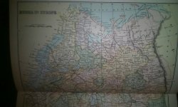
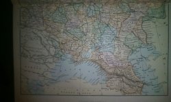
Found this map in the front of the Encyclopaedia volume. Best resolution this tablet can manage. I'll try a camera tomorrow if needed.

IMG_20231219_181119_280.jpg IMG_20231219_181055_377.jpg
 
It's much easier to say that cartographers were a bunch of morons, who did not know what they were doing
Why do people have the tendency to twist in the wrong way what I say? I never said that! All I was trying to point out is that map making was really hard and a dangerous business in 1600. They were traveling on horse and carts in a caravan through the most beaten path of other caravans and they were able to chart the route and the towns and cities along that route with good accuracy, but outside the path there was endless desert in which no one ventured to go in because it meant death due to lack of water and food. No one is idiot enough to go 50-60 km outside of the beaten path, not even cartographers where it is just the unknown and you can go but risk to not come back.

So the accuracy of the maps is build along these long strings or routes that run for 100s kms or more but what's in between them is inaccurate. This is what I meant previously, not that map makers are morons. They did what they did for money, because they were rewarded handsomely by rich merchants in Europe like the Venetians, the Dutch etc who wanted to venture their merchandise into the Orient, and all they needed was travel routes, where they could know how many bandits are and what's the fee to pay to "desert pirates" so they cold calculate the total cost of business, including travel fees and risk of theft. They were not interested in counting parallels of meridians. Time travel was not a problem back then, if the journey took an additional week, it was fine for them so an approximate distance from point to point was more than enough. They just slapped a grid system over the map once they were done with their charting.

I'm 40 and I've been in the military since 17. Two tours in Irak and three in Afghanistan. Know them like the palm of my hands due to extensive travel. The maps used when you're on foot are 1:25.000 the most common one, you go for 2-3 dozens of kms with it until you're exhausted. The 1:50.000 is not suitable for on foot travel, you start to not recognize the geographical features anymore from your perspective compared with the map's ones and people get confused.

The maps of the scale from 1:150.000 to 1:250.00 and above are used by the Air Force because they have fast movers and that's the scale that makes sense for them, similar to the old maps you KD are worshiping like it is the ultimate truth.

Deep reconnaissance patrols in the deserts of Afghanistan were getting lost without GPS signal when they went deep for dozens of kms in surveillance, we had to rescue them with rotary wings because they were like sitting ducks in the middle of nowhere in a desert filled with mountain ranges. They had no idea where they were after a while even though they were briefed before mission extensively. Those were lessons learned for the US Army, people rely too much on technology.

If I was to take your ass and send it to Jalalabad or Kandahar with a 1:25.000 map, a compass and a pair of binoculars in the middle of nowhere and the closest urban center would be 70 km away from you in a random direction marked also in the map. Your ass would die out and became food for insects. That's how difficult it is without points of reference in your sight.

So now you're saying to me that cartographers made everything perfectly on their maps. But sure, you know it all. You know it from the comfort of your computer seat, you travel the world and time itself through internet. Wow. What a genius?
 
Last edited:

Similar articles

Back
Top